Property Record
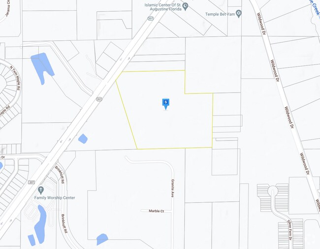
207 Stratton Rd, Saint Augustine, FL 32095
Property Detail
207 Stratton Rd
Jacksonville, FL
7-2 & 8 PT OF NE1/4 OF SEC 3 T8S R29E LYING E OF SR 207 (EX FDOT TAKING CASE#95-499) (EX OR5398/574) (EX OR5653/342) (EX OR5663/474) (EX OR5713/551) (EX OR5765/1973) OR5064/645 & 5293/219 & 5293/431
135990-0020
ST. JOHNS
Commercialacreage
Florida
2025
19.37 AC
2025
St Johns County
021207
Jacksonville (Florida)
NEARBY LISTINGS FOR SALE OR LEASE
DEMOGRAPHICS near 207 Stratton Rd
1 mile
3 mile
5 mile
2024 Total Population
3,920
25,141
63,906
2029 Population
5,265
33,379
84,784
Pop Growth 2024-2029
+ 34.31%
+ 32.77%
+ 32.67%
Average Age
44
45
46
2024 Total Households
1,515
10,182
27,128
HH Growth 2024-2029
+ 34.13%
+ 32.49%
+ 32.55%
Median Household Inc
$80,116
$67,899
$65,603
Avg Household Size
2.50
2.40
2.20
2024 Avg HH Vehicles
2.00
2.00
2.00
Median Home Value
$334,413
$287,569
$279,784
Median Year Built
2004
1997
1996
Nearby Places
Map Layers
Map Styles
 Street
 Aerial
Transit
 Traffic
 Biking
Places
Listings with unknown addresses are not visible on the map
- Restaurants
- Banks
- Shops
- Fitness
- Groceries
Nearby Properties
Address
Land Use
TOTAL SIZE
Lot Size
Zoning
Address
Land Use
TOTAL SIZE
Lot Size
Zoning
102,311 SF
7.21 AC
PUD
Address
Land Use
TOTAL SIZE
Lot Size
Zoning
67,311 SF
7.28 AC
PUD
Address
Land Use
TOTAL SIZE
Lot Size
Zoning
268.05 AC
Address
Land Use
TOTAL SIZE
Lot Size
Zoning
20,790 SF
22.47 AC
Address
Land Use
TOTAL SIZE
Lot Size
Zoning
65.40 AC
Address
Land Use
TOTAL SIZE
Lot Size
Zoning
21,579 SF
3.96 AC
PUD
Address
Land Use
TOTAL SIZE
Lot Size
Zoning
703 SF
4.41 AC
Address
Land Use
TOTAL SIZE
Lot Size
Zoning
8,018 SF
5.26 AC
IW
Address
Land Use
TOTAL SIZE
Lot Size
Zoning
7,200 SF
4.73 AC
CI
Address
Land Use
TOTAL SIZE
Lot Size
Zoning
19,450 SF
6 AC
IW
Address
Land Use
TOTAL SIZE
Lot Size
Zoning
7,967 SF
12.90 AC
IW/OR
Address
Land Use
TOTAL SIZE
Lot Size
Zoning
11,139 SF
2.75 AC
CI
Address
Land Use
TOTAL SIZE
Lot Size
Zoning
44,150 SF
2.75 AC
Address
Land Use
TOTAL SIZE
Lot Size
Zoning
9,706 SF
0.69 AC
PUD
Address
Land Use
TOTAL SIZE
Lot Size
Zoning
9,350 SF
4.92 AC
IW
Address
Land Use
TOTAL SIZE
Lot Size
Zoning
14,024 SF
1.82 AC
Address
Land Use
TOTAL SIZE
Lot Size
Zoning
Address
Land Use
TOTAL SIZE
Lot Size
Zoning
5,346 SF
1.92 AC
PUD
Address
Land Use
TOTAL SIZE
Lot Size
Zoning
1,228 SF
1.93 AC
IW
Address
Land Use
TOTAL SIZE
Lot Size
Zoning
3.49 AC
IW
Address
Land Use
TOTAL SIZE
Lot Size
Zoning
Address
Land Use
TOTAL SIZE
Lot Size
Zoning
6,340 SF
1.88 AC
DRI
Address
Land Use
TOTAL SIZE
Lot Size
Zoning
12,868 SF
1.58 AC
DRI
Address
Land Use
TOTAL SIZE
Lot Size
Zoning
11,060 SF
5.59 AC
Address
Land Use
TOTAL SIZE
Lot Size
Zoning
1,544 SF
285.70 AC
OR
Address
Land Use
TOTAL SIZE
Lot Size
Zoning
3,000 SF
13.99 AC
IW
Address
Land Use
TOTAL SIZE
Lot Size
Zoning
Address
Land Use
TOTAL SIZE
Lot Size
Zoning
9.69 AC
Address
Land Use
TOTAL SIZE
Lot Size
Zoning
364.82 AC
Address
Land Use
TOTAL SIZE
Lot Size
Zoning
6.03 AC
AD
The World's #1 Commercial Real Estate Marketplace
Connect with us
© 2026 CoStar Group
The information above has been obtained from sources believed reliable. While we do not doubt its accuracy we have not verified it and make no guarantee, warranty or representation about it. It is your responsibility to independently confirm its accuracy and completeness. Any projections, opinions, assumptions, or estimates used are for example only and do not represent the current or future performance of the property. The value of this transaction to you depends on tax and other factors which should be evaluated by your tax, financial, and legal advisors. You and your advisors should conduct a careful, independent investigation of the property to determine to your satisfaction the suitability of the property for your needs.